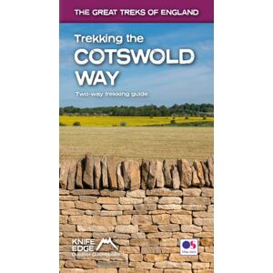
The definitive two-way guide to the Cotswold Way: both southbound and northbound routes are described in full. Real Maps: Full Ordnance Survey mapping inside (1:25,000).All accommodation is numbered and marked on the maps18 different itineraries: schedules of 4, 5, 6, 7, 8, 9, 10, 11 and 12 days for hikers and runners.Includes both southbound and northbound itineraries.Difficult calculations of time, distance and altitude gain/loss are done for you. Also includes:* Detailed information on equipment and travelling light* Everything the trekker needs to know: route, costs, difficulty, weather, travel, and more* Full accommodation listings: the best inns, B&Bs and hotels* Detailed section on camping* What to see in the City of Bath* Essential info for both self-guided and guided trekkers* Information on history, plants and wildlife* Numbered waypoints linking the Real Maps to our clear descriptionsThe Cotswold Way travels 102 miles through the sublime scenery of the Cotswolds, a region which is the epitome of historic England.Along the way, you will travel the crest of the Cotswold Escarpment through exquisite rolling countryside and historic chocolate-box villages, built from lovely honey-coloured stone, which have remained unchanged for centuries. The trekker negotiates this wonderful terrain on a meticulously waymarked series of paths and tracks, far removed from the region's large urban centres.Occasionally, you will pass through a small village or hamlet (with little more than a local pub and a few places to stay) but otherwise, the experience is one of tranquillity.This is England at its best and it will be an adventure that you will never forget.